File:Beijing map 1900.jpeg
Jump to navigation
Jump to search


Size of this preview: 647 × 600 pixels. Other resolution: 1,137 × 1,054 pixels.
Original file (1,137 × 1,054 pixels, file size: 310 KB, MIME type: image/jpeg)
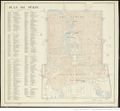
Title : Plan de Pékin Autor : France. Service géographique de l'Armée (Paris) Published : 1900 Source : Bibliothèque nationale de France, département Cartes et plans, GE B-9975 Published online : 19/11/2017 Original fine : [1]
File history
Click on a date/time to view the file as it appeared at that time.
| Date/Time | Thumbnail | Dimensions | User | Comment | |
|---|---|---|---|---|---|
| current | 05:28, 19 November 2018 |  | 1,137 × 1,054 (310 KB) | Sherstiuk (talk | contribs) | Reverted to version as of 09:31, 19 October 2018 (CEST) |
| 01:03, 19 November 2018 |  | 6,360 × 9,029 (1.91 MB) | Jimwang (talk | contribs) | ||
| 07:31, 19 October 2018 |  | 1,137 × 1,054 (310 KB) | Sherstiuk (talk | contribs) | '''Title :''' Plan de Pékin '''Autor :''' France. Service géographique de l'Armée (Paris) '''Published :''' 1900 '''Source :''' Bibliothèque nationale de France, département Cartes et plans, GE B-9975 '''Published online : ''' 19/11/2017 '''Or... |
You cannot overwrite this file.
File usage
The following page uses this file: