Extracting Toponyms from Maps of Jerusalem: Difference between revisions
Jump to navigation
Jump to search
| Line 32: | Line 32: | ||
! Task | ! Task | ||
! Completion | ! Completion | ||
|- | |- | ||
| | |Week 4 | ||
| | | | ||
* | * Finalize and present project proposals. | ||
| align="center" | ✓ | | align="center" | ✓ | ||
|- | |- | ||
| Line 47: | Line 42: | ||
|By Week 5 | |By Week 5 | ||
| | | | ||
* | * Survey SOTA toponym extraction tools. | ||
* Implement MapKurator | |||
| align="center" | ✓ | | align="center" | ✓ | ||
|- | |- | ||
Revision as of 13:26, 5 December 2023
Introduction & Motivation
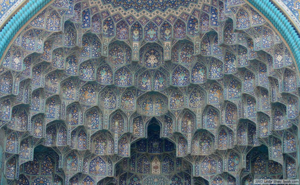
1. Simple Muqarnas: the ceilings have plane surfaces only
| [[]] |
Methodology
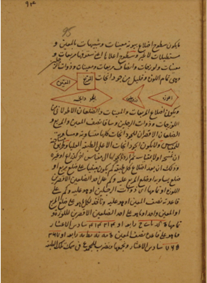
Create the shapes in 2D
Transform the shapes in 3D
The Arc from the Method of Masons
The 3D Projection
Create the 2D plan and the 3D volume
- Step 1:
- Step 2:
In practice
Project Plan
| Date | Task | Completion |
|---|---|---|
| Week 4 |
|
✓ |
| By Week 5 |
|
✓ |
| By Week 6 |
|
✓ |
| By Week 7 |
|
✓ |
| By Week 8 |
|
✓ |
| By Week 9 |
|
✓ |
| By Week 10 |
|
✓ |
| By Week 11 |
|
✓ |
| Week 12 |
|
✓ |
| Week 13 |
|
✓ |
| Week 14 |
|
✓ |
Results
Limitations
Future work
Github Repository
References
Literature
- Kim, Jina, et al. "The mapKurator System: A Complete Pipeline for Extracting and Linking Text from Historical Maps." arXiv preprint arXiv:2306.17059 (2023).
- Li, Zekun, et al. "An automatic approach for generating rich, linked geo-metadata from historical map images." Proceedings of the 26th ACM SIGKDD International Conference on Knowledge Discovery & Data Mining. 2020

