A century in Beijing
Jump to navigation
Jump to search
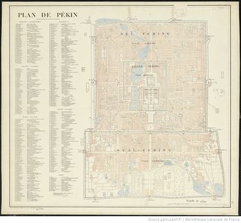
Using this map by France's Service Géographique de l'Armée from 1900 we will follow the evolution of the urban landscape of the central part of China's capital at several milestones through the decline of Qing dynasty, the birth of a republic, the establishment communism to the modern times. The city grew vey quickly over the last hundred years and is now way past its old borders. While some things in the downtown remained pretty unchanged like the Tiananmen Imperial Palace, numerous old constructions were demolished in an effort to modernize the town.
The goals
- To align maps from different time periods and see how the landscape changed. The town's straightforward rectangular planning will allow us to make matches more easily.
- The map has a rich legend with toponymic information in French and the dated French system of transliteration of Mandarin. The plan is to extract and match these place names with their modern counterparts.
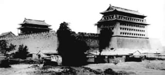
- Add the old pictures of significant buildings that are no longer there if it's possible to find them.

