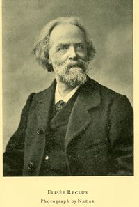
Elisée Reclus
Introduction
Élisée Reclus (March 15th 1830 in Sainte-Foy-la-Grande, France - July 4th 1830 in Torhout, Belgium) was a French geographer, a writer and a political activist.
By the end of the 19th Century, Reclus came with the project of creating a 127,5m diameter wide, comprehensive representation of the globe's surface at a scale of 1:100'000. As such, he can be seen as a precursor of modern mapping services that allow one to browse the entirety of the planet.
However, the purpose of the Great Globe was not only to account for the topographical relief of the Earth, but also to represent the wide variety of life happening on its surface, from landscapes, plants and animal life to humans culture and traditions. His desire was for the Great Globe to account for all "manifestations of life on Earth".
It should have been built in Paris for all to see and learn. Although for lack of financial support, he could not realise his ambitious project. He did however publish a handful of "globular maps" that attempted to to represent the Earth in a brand new manner, but which did not encounter the expected success. [1]
